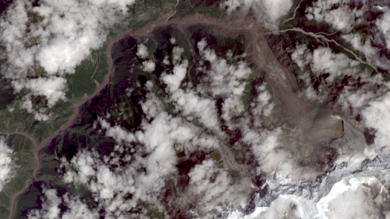
The roof of the world is fracturing, and the consequences are rolling down into valleys with terrifying speed. When a massive chunk of the Langtang Lirung glacier fractured at 5,200 meters above sea level on August 26, it didn't just drop ice. It triggered a cryosphere-bedrock coupling failure that sent roughly one million cubic meters of ice, rock, and debris tearing down a 22-kilometer path in a mere seven minutes.
Hitting speeds of up to 19 meters per second, the slurry obliterated the China-Nepal border port of Gyirong, cutting off power, wiping out roads, and leaving thousands dead or missing across the region. This wasn't an ordinary seasonal flood. There was no heavy rainfall to blame. Instead, it was a stark demonstration of how climate heating is destabilizing high-altitude permafrost and glacier foundations across the Tibetan Plateau and the broader Hindu Kush Himalaya.
If you think this is an isolated incident confined to remote Himalayan peaks, you're missing the wider reality. High-mountain environments are warming significantly faster than the global average, a phenomenon known as elevation-dependent warming. As glaciers retreat and permafrost thaws, slopes lose the structural support they once relied on. The result is a dangerous chain reaction of cascading hazards that traditional disaster planning is entirely unequipped to handle.
The Anatomy of a High-Altitude Disaster
Most people picture glacier hazards as slow-moving ice retreats or simple glacial lake outbursts. But the recent catastrophe on the Tibet-Nepal border exposes a much faster, deadlier threat profile.
When a massive ice mass collapses from thousands of meters up, it acts like a giant snowplow. It scours riverbeds, tears loose soil and boulders from valley walls, and bulks up into a high-velocity debris flow. According to data from the Institute of Tibetan Plateau Research of the Chinese Academy of Sciences and analysis by organizations like the US Geological Survey, these sudden rock-ice avalanches can travel immense distances before anyone downstream has time to evacuate.
Consider what happened at Gyirong Port. The sudden influx of debris blocked the local river channel, forming a temporary barrier lake that threatened subsequent catastrophic breaches. Rescue operations faced extreme logistical nightmares because bridges, tunnels, and arterial roads were entirely erased in minutes. When disasters happen this fast, early warning systems based solely on downstream water gauges are basically useless.
Why Traditional Risk Models Fail
Governments and engineering firms have spent decades building infrastructure along mountain corridors assuming that historical weather patterns will repeat themselves. That assumption is now obsolete.
- Elevation-dependent warming: Mountains are heating up at nearly double the global average rate, rapidly destabilizing ice-rock bonds that held firm for centuries.
- Compound failures: A single event now rarely occurs in isolation. An ice avalanche triggers a landslide, which blocks a river, creating an unstable natural dam that eventually bursts into a downstream flash flood.
- The data gap: Only a tiny fraction of high-altitude glaciers and permafrost zones are continuously monitored with seismic sensors, automated cameras, and high-resolution satellite tracking.
When researchers look back at historical data, the trend is undeniable. ICIMOD assessments show that glaciers across the Hindu Kush Himalaya lost roughly 12 percent of their area between 1990 and 2020, with ice loss rates doubling since 2000. Every ton of lost ice represents a microscopic shift in tectonic and gravitational equilibrium.
Rethinking Mountain Safety and Cross-Border Resilience
The tragedy along the China-Nepal border proves that environmental shocks don't respect national boundaries. Whether it's the 2021 Chamoli disaster in India or the recent devastation in the Bhotekoshi river system, mountain economies are increasingly vulnerable to high-altitude cryosphere shifts.
Protecting downstream communities requires shifting from reactive disaster response to predictive, high-altitude monitoring. Authorities must deploy real-time seismic monitoring, satellite-based radar interferometry to track slope movements before they fail, and automated early-warning networks linked directly to vulnerable valley settlements.
The physical geography of the Himalayas has fundamentally changed. Ignoring the instability of the Tibetan Plateau won't stop the ice from falling. Survival in this new era requires treating high-mountain stability as a critical infrastructure priority before the next valley gives way.


