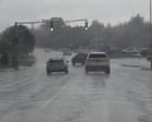
Millions of people across the northeastern United States are currently dealing with a brutal mix of torrential rain, severe flash flooding, and destructive winds. If you live anywhere from New York up through New England, you already know the disruption is real. Flights are grounded, roads are turning into rivers, and emergency responders are pulling people out of cars.
This isn't a normal summer rain shower. It's a high-end atmospheric setup bringing up to eight to twelve inches of rain to parts of Massachusetts, Connecticut, and eastern New York.
What Is Actually Happening on the Ground
The Weather Prediction Center slapped parts of the tri-state area and New England with a moderate risk of excessive rainfall, translating to a Level 3 out of 4 threat. Stationary convergence axes are locking storms in place over the same communities for hours on end. When rain falls at rates of one to two inches per hour over saturated ground, urban drainage systems simply fail.
We've already seen the human toll. A 32-year-old man was killed by a lightning strike in Monroe Township, New Jersey. Fire departments in places like Paterson, New Jersey, and Reading, Pennsylvania, have executed high-water rescues, pulling trapped residents and families out of stranded vehicles.
Hundreds of thousands of homes lost power. Major airports face massive delays and cancellations.
The Dual Threat of Floods and Extreme Heat
While the Northeast drowns, the rest of the country is baking under a persistent summer heat dome. Texas and Oklahoma are looking at heat indices climbing up to 115°F. Out west, cities like Phoenix, Las Vegas, and Palm Springs are staring down temperatures reaching 120°F.
This stark contrast highlights why modern weather patterns feel so volatile. You have deep moisture feeding torrential systems in one region while a massive ridge of high pressure bakes the south and west, creating a significant wildfire risk from California up to Oregon.
Meanwhile, Wisconsin is still picking up the pieces from an EF3 tornado that struck the Fox Valley with 145 mph winds, injuring dozens. Summer weather has turned hyper-aggressive.
How to Protect Yourself Right Now
If you're in an active flash flood zone, standard rules save lives. Don't drive through standing water. It takes remarkably little moving water to sweep a car away. Keep your devices charged because local grids are failing under high wind gusts and lightning strikes.
Check your basement drains and move valuables away from low points if you live in a flood-prone valley or urban basin. Weather forecasting models are getting better at pinpointing these stationary storm bands, but the margin for error is razor-thin when storms stall over populated areas.
Stay off the roads, monitor local National Weather Service alerts, and don't assume your neighborhood is safe just because it sunny-skied an hour ago.