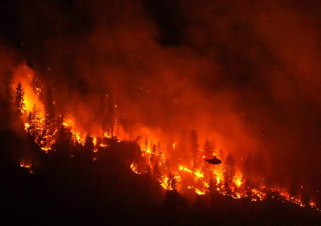
Thousands of residents and property owners remain locked out of their homes along the west side of Okanagan Lake as the aggressive Quilpituk Creek wildfire refuses to back down. If you are watching the situation unfold from afar, the numbers can feel abstract. But on the ground in the Central Okanagan, it is a tense reality of roadblocks, heavy smoke, and endless waiting.
The BC Wildfire Service pegs the Quilpituk Creek wildfire at roughly 550 hectares, and crucially, it remains out of control. Over 2,200 properties sit under active evacuation orders, while hundreds more remain on alert. If you live in zones like Caesars Landing or nearby interface areas, going home today isn't an option. Local officials have made it clear that changing weather and volatile fire behavior mean those safety restrictions aren't budging.
Understanding the Pressure on Westside Road
Westside Road has transformed into a restricted, high-stakes operational zone. North of Caesars Landing, civilian traffic is completely blocked. Heavy equipment teams, local fire departments from across the Central Okanagan, and specialized structure protection crews are using the corridor to stage equipment and build defensible lines.
Why is this specific terrain so difficult to manage? Wildfire interface zones along steep lake banks create unpredictable wind tunnels. When a fire sparks—like this one did on a Saturday night—it exploits dry timber and erratic gusts, moving faster than ground crews can physically dig handguards.
Crews are currently cutting danger trees and laying down extensive hoselay systems to deliver direct water to the fire's blistering edges. It is grueling, dangerous work. Falling burnt timber poses an immediate hazard to anyone on the line, which slows down direct containment efforts.
Where Evacuees Are Finding Support
Displaced residents cannot simply return until authorities complete infrastructure assessments. Power lines are down, water systems require testing, and many access roads are choked with debris.
If you or someone you know has been forced out by the Quilpituk Creek or neighboring Bradley Creek fires further north, emergency infrastructure is active:
- Group Lodging: Royal LePage Place Arena on Cameron Road is open for evacuees needing overnight support, complete with cots, food services provided by the Salvation Army, and first aid.
- RV and Trailer Parking: Mount Boucherie Secondary School is accommodating self-contained rigs in its parking lot.
- Registration & Aid: Emergency Support Services operates reception facilities to help families secure food, clothing, and incidentals.
What to Watch Next
Evacuation fatigue is real. Staying informed through official channels like Central Okanagan Emergency Management (coemergency.ca) is your best defense against rumors spreading on social media. Check your specific street address on their interactive maps rather than relying on generalized regional updates.
Keep your emergency grab-and-go bag packed if you are on an alert status. Conditions can shift in minutes. Monitor local utility maps for power restoration timelines, and stay completely clear of any aircraft scooping water from Okanagan Lake.
Check your local emergency portal for the latest perimeter maps and re-entry phases before attempting to approach any closed zones.