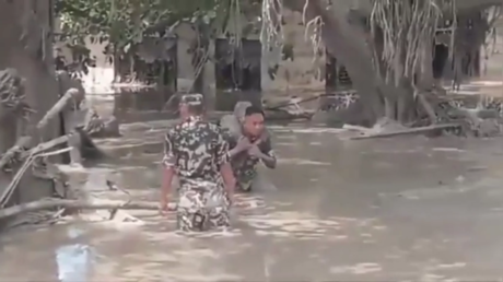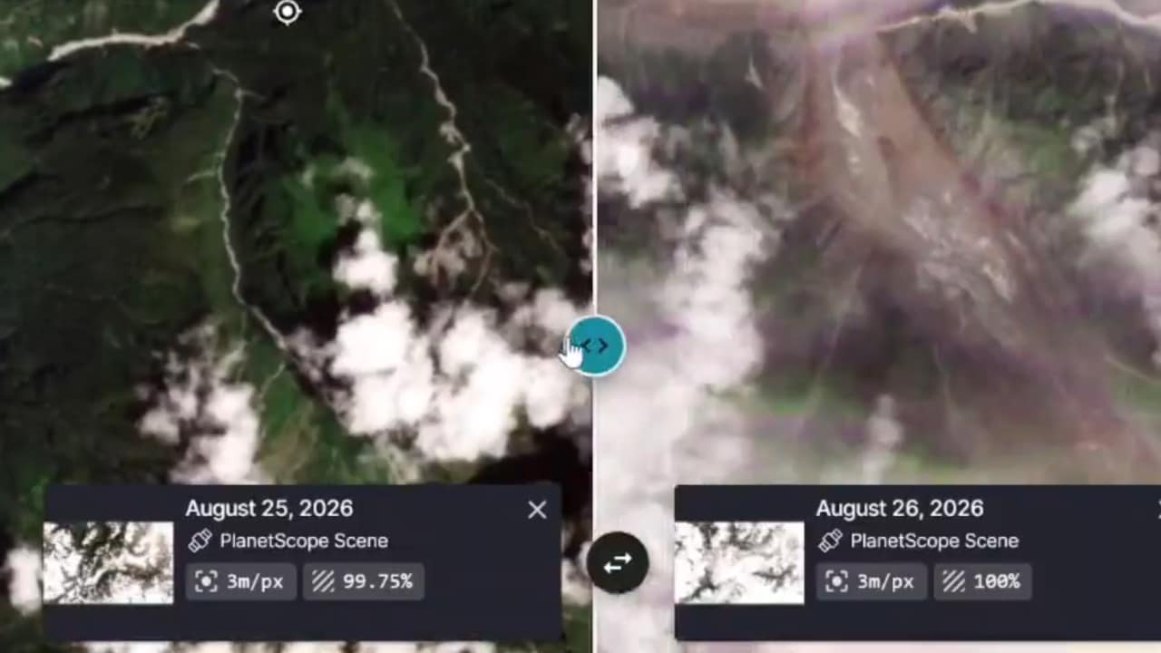
When a wall of water tore down the Bhote Koshi and Lhende Khola river valleys near the Nepal-China border, it left villages buried in mud and emergency services scrambling for answers. High-resolution orbital data provided the first real clue about what actually happened up in the peaks. Analysts examining before-and-after imagery from Planet Labs pinpointed a massive ice-rock landslide roughly twenty kilometers northeast of the Rasuwagadhi border crossing.
If you have spent any time tracking Himalayan climate disasters, you know official explanations often lag behind reality. Let's look past the initial confusion and examine what the orbital scans reveal about this catastrophe.
Reading the High-Altitude Scar
High-altitude disasters rarely happen without leaving physical evidence on the slopes. According to assessments shared by Nepal's National Disaster Risk Reduction and Management Authority (NDRRMA), a destabilized section of mountain mass and glacial ice collapsed suddenly. This avalanche of debris crashed directly into the Lhende Khola riverbed.
Think of it like a temporary natural dam. When millions of tons of pulverized ice, mud, and rock suddenly block a narrow mountain stream, water backs up behind it rapidly. The pressure builds until the makeshift barrier fails completely, sending a destructive, debris-laden torrent downstream.
Eyewitness and CCTV footage from the Gyirong Port area in Tibet captured the terrifying speed of the surge as it overwhelmed infrastructure before barrelling across the international border into Nepal's Rasuwa district.
Separating Landslides From Earthquakes
Initial reports threw contradictory terms around—some blamed local seismic tremors, while others suspected a classic glacial lake outburst flood, commonly known as a GLOF. Seismological monitors later clarified that the massive energy spike registered during the event matched a powerful landslide equivalent to a 5.2 magnitude event, rather than a deep tectonic earthquake initiating the sequence.
Glaciologists studying the orbital framing noted that the mechanics looked less like an overflowing lake and more like a high-elevation ice mass snapping off cleanly under atmospheric and thermal stress. When a massive section of frozen debris drops thousands of feet vertically, the impact pulverizes the ice into a liquid-solid mixture that behaves like a fast-moving fluid.
Why the Himalayas Are Changing Too Fast
You cannot look at events like this without addressing the broader environmental reality of the region. Hindu Kush Himalayan glaciers are losing mass at an accelerating pace. Rising temperatures destabilize steep rock walls that spent centuries frozen solid.
When permafrost melts, slopes that look permanent become ticking clocks. Communities living along these steep river corridors face recurring risks that standard flood-defense infrastructure simply cannot stop.
Recovery teams continue to battle blocked roads, heavy sediment, and unstable terrain to reach vulnerable settlements. Understanding whether an ice avalanche or a localized rock failure started the cascade helps disaster planners model future risks, but for the families whose homes were washed away, the immediate priority remains finding survivors and rebuilding from the slush.