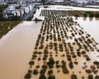
When flash floods turn coastal streets into churning rivers, municipal alerts on a phone screen feel terribly small. Central Greece and western Turkey are once again grappling with severe rainfall and flood warnings that expose how fragile our local infrastructure remains against shifting weather patterns. If you think this is just standard autumn rain, you are missing the bigger picture.
Meteorological agencies across the region have raised alarms as deep low-pressure systems stall over the Aegean Sea. These aren't passing afternoon showers. They are slow-moving atmospheric traps dumping historic volumes of water onto saturated soils, urban pavement, and vulnerable coastlines.
The Anatomy of the Regional Crisis
Heavy downpours hitting regions like Western Turkey and parts of central Greece don't happen in a vacuum. Scientific analysis from meteorological networks indicates that weather setups responsible for recent extreme flooding bring about 7% heavier rainfall and significantly stronger winds compared to historical baselines from decades past.
When over 200 millimeters of rain fall within a matter of hours—as recorded in parts of Rhodes and Istanbul districts during recent storms—drainage systems designed decades ago simply give up. Water has nowhere to go. It surges down hillsides, collapses road sections, and fills underground parking structures before residents have time to move their vehicles.
What the Warnings Mean for Residents on the Ground
When authorities issue high-level flood warnings, the difference between safety and disaster often boils down to immediate action. Yet, complacency remains a massive hurdle.
- Flash Floods Move Fast: Urban runoff turns dry asphalt into a fast-moving current in less than ten minutes. Driving through standing water is basically gambling with your life.
- Infrastructure Strain: Culverts and riverbeds choked with debris cannot handle sudden volume spikes, causing rivers to breach their banks unexpectedly.
- Evacuation Orders: When civil protection services tell you to move to higher ground, waiting to see if the rain stops is a dangerous mistake.
Why Urban Centers Are Sitting Ducks
Take a close look at how modern cities are built along the Mediterranean and the Marmara Sea. Decades of rapid expansion replaced natural absorption areas with concrete and asphalt. Rainwater can't soak into the earth, so it accumulates on the surface, overwhelming storm drains that lack the capacity for modern storm intensity.
In Istanbul and surrounding western Turkish provinces, heavy downpours recently triggered traffic congestion reaching up to 90% of the city network, stranding commuters and forcing hundreds of emergency rescues. Meanwhile, Greek islands like Skiathos and Rhodes have seen cars swept directly into the sea by sudden torrents rushing down from interior ridges.
Preparing for the Next Wave
We can't stop heavy rainfall, but we can change how we respond to recurring weather threats. Municipalities need to upgrade stormwater management aggressively, clearing blocked river channels and expanding retention basins.
On an individual level, stop ignoring weather alerts. Keep emergency kits stocked, know your local evacuation routes, and never underestimate a flooded roadway. If the water looks deep enough to hide the curb, turn around.
The climate reality across southeastern Europe is shifting fast. Staying safe requires respecting the water and demanding better urban resilience before the next storm hits.