High-altitude ice doesn't just melt quietly anymore. It shatters, drops thousands of meters in minutes, and turns mountain valleys into high-speed conduits of destruction.
When a massive high-altitude glacier collapse struck the Nepal-China border region recently, it sent an incredible wave of ice, rock, and slurry roaring down toward Gyirong Port. What makes this event terrifying isn't just the catastrophic loss of life and infrastructure—including hundreds of casualties and severe disruptions across the region—it's the sheer physics of how a disaster unfolding at 5,140 meters can travel 20 kilometers in roughly seven minutes.
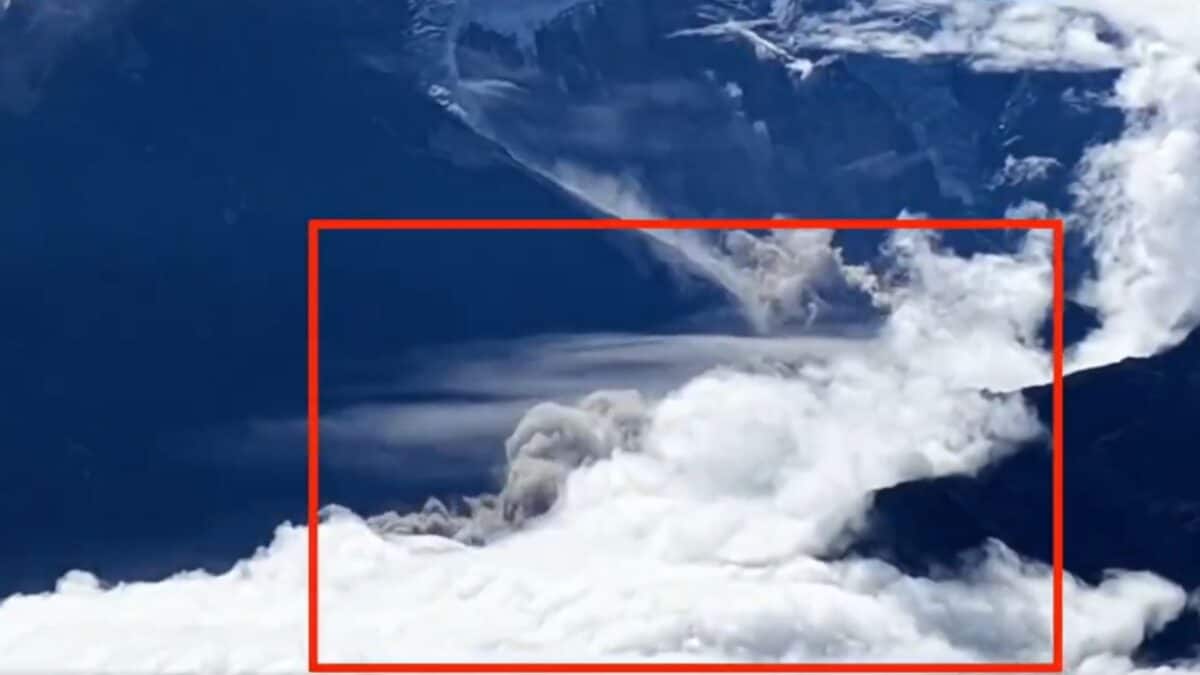
If you think natural disasters in the Himalayas are predictable seasonal floods, you're missing the bigger picture. This incident, captured accidentally on camera by a tourist filming the landscape in China's Xizang Autonomous Region, exposes a dangerous new reality of high-mountain instability.
The Physics of a Seven-Minute Catastrophe
Let's look at the numbers because they reveal how fast mountain ecosystems can turn lethal.
The ice-rock collapse happened at an elevation of roughly 5,140 meters, covering an expansive area of about 620,000 square meters. The resulting debris flow dropped a staggering 3,300 meters in elevation as it careened through mountain valleys.
Think about that drop. Gravity converted millions of tons of displaced ice and rock into an unstoppable projectile. Travelling nearly 20 kilometers in about seven minutes means the slurry moved at speeds that left zero reaction time for communities, workers, or travelers in its path.
Kang Shichang, director of the Institute of Mountain Hazards and Environment under the Chinese Academy of Sciences, confirmed that remote-sensing imagery matched the tourist footage frame for frame. This wasn't a slow-moving mudslide caused by heavy monsoon rains. It was a sudden, high-altitude structural failure of a glacier that instantly liquefied into a raging avalanche of debris.
Why Gyirong Port and Border Regions Are Vulnerable
Borders in high-mountain terrain are notoriously difficult to monitor. Gyirong Port sits in a rugged geopolitical and geographical chokepoint between Nepal's Bagmati province and China's Tibet Autonomous Region.
When disasters strike these remote trade hubs, response times dictate survival rates. The initial impact flattened roads, bridges, and infrastructure on both sides of the border. Rescue operations faced immediate bottlenecks. In Nepal, heavy rain and rising river levels in regions like Trishuli forced authorities to temporarily ground helicopter operations, stranding rescue efforts when every second counted.
The human toll has been devastating, with hundreds of fatalities reported in Nepal, alongside significant missing person counts in Tibet. Evacuating thousands of stranded individuals—including tourists, locals, and international travelers such as Indian pilgrims visiting for the Kailash Manasarovar Yatra—proved to be a logistical nightmare for local defense and emergency crews.
The Looming Threat of Barrier Lakes
Stopping the initial debris flow doesn't mean the danger has passed. In fact, what happens after the collapse often creates an even greater hazard.
Following the event, authorities detected a newly formed barrier lake at the confluence of the Chhochen Khola and Purepu Tsangpo rivers. China subsequently sounded a Level-IV alert, setting up monitoring posts to watch the water closely.
Why are barrier lakes so dangerous? When debris dams a river, water pools rapidly behind an unstable wall of loose rock and earth. If that natural dam breaches—even partially—it triggers a secondary flash flood that can send hundreds of cubic meters per second rushing downstream without warning. Officials noted concerning changes, including a gradual darkening of the water, pointing to ongoing instability upstream.
What This Means for Mountain Infrastructure Going Forward
We need to rethink how we build, travel, and monitor high-altitude corridors. Traditional hazard mapping relies on historical weather patterns and gradual seasonal runoff models. Those models are failing.
- Real-time remote sensing is mandatory. Waiting for a disaster to hit social media or official radar is no longer acceptable. High-resolution satellite monitoring and automated acoustic sensors near unstable glaciers can buy critical minutes for evacuation.
- Cross-border early warning systems must improve. Disasters don't check passports at the border. When a glacier collapses in Nepal and impacts infrastructure in Tibet, real-time data sharing between nations is the difference between life and death.
- Infrastructure resilience needs a complete overhaul. Hydropower tunnels, border trading posts, and pilgrimage routes built in narrow river valleys are prime targets for high-altitude debris flows. Engineering standards must account for multi-kilometer drops and massive kinetic energy impacts.
The mountain landscape is shifting, and our safety protocols need to catch up before the next ridge gives way.